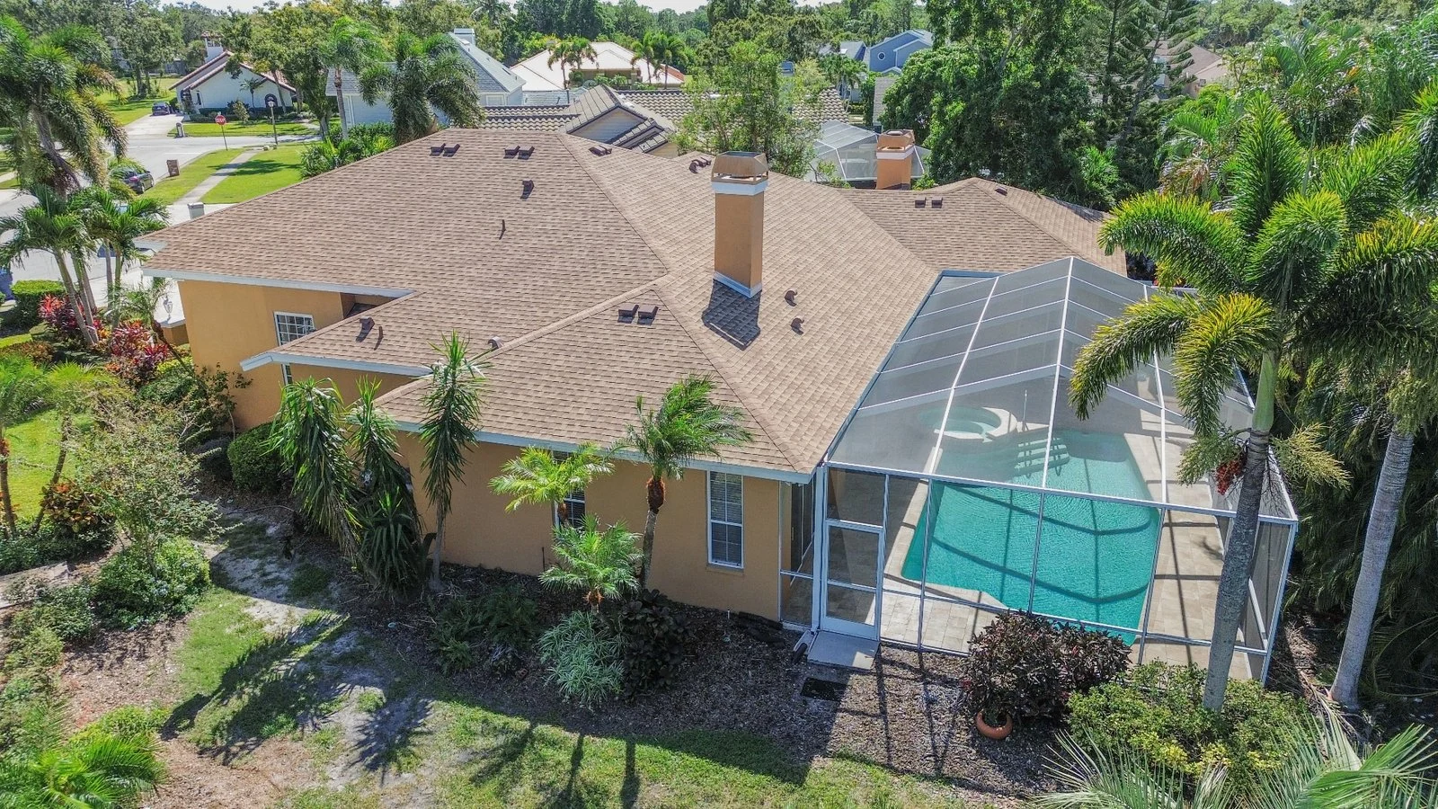
Aerial photography can answer questions that ground-level images cannot: How does the home sit on the lot? Where is the water? How close is the property to a park, road, downtown, or shoreline? Which structures belong together?
That makes drone media useful for some listings and unnecessary for others. The right starting point is the information an aerial view needs to communicate.
When aerial images add real information
- A large, unusually shaped, waterfront, agricultural, or multi-structure property.
- A home with meaningful proximity to a beach, marina, golf course, trail, or business district.
- A roof, solar installation, pool layout, dock, detached building, or landscape plan that is difficult to understand from the ground.
- A neighborhood where street pattern, gates, amenities, or natural boundaries matter.
A conventional suburban home may still benefit from one elevated front view and one context image. It usually does not need a dozen nearly identical overhead photographs. Each frame should answer a different question.
Commercial real estate drone work is regulated
In the United States, taking drone photos to help sell a property is a non-recreational operation. The Federal Aviation Administration directs business-purpose operators to follow the Small UAS Rule, commonly called Part 107. The remote pilot must hold the appropriate certificate, and the aircraft must meet applicable registration and operational requirements.
Airspace matters even at a low altitude. Controlled airspace near airports may require authorization. The FAA identifies LAANC and DroneZone as pathways for requesting certain authorizations. Approval can depend on the exact address, altitude, time, and airspace.
What an agent should provide before the flight
- The exact property address and parcel boundaries if they are unclear.
- The features that matter most: water access, acreage, roof, solar panels, outbuildings, neighborhood amenities, or proximity.
- Known access limitations, gates, pets, active construction, or occupied neighboring areas.
- Any property feature that should not be implied as part of the sale.
- The intended use of the images, especially if the project extends beyond a standard listing.
If a nearby amenity appears in the marketing, describe the relationship accurately. An oblique aerial can show context without suggesting that a neighboring dock, vacant lot, or recreation area is included with the property.
Useful aerial shot types
Elevated front view
This is often the most broadly useful angle. It keeps the home recognizable while showing roofline, driveway, front landscape, and nearby context.
Forty-five-degree corners
Front and rear corner views can explain depth, additions, pool placement, and how outdoor areas connect to the structure.
Top-down site view
A true overhead image is good for lot organization, but it can flatten architecture. Use it when the layout itself is the point.
Context view
A wider frame can establish proximity to a coast, community feature, or road network. It should still be close enough for viewers to identify the subject property.
Weather, sun, and timing
Wind affects both safety and image consistency. Rain and low cloud can remove useful distance detail. Strong midday sun can create short, hard shadows; lower sun can reveal texture but may put a façade in shade. In Florida, rapidly changing weather makes a flexible plan valuable.
Night and twilight operations have additional equipment and operational requirements. FAA guidance says Part 107 pilots operating at night must use anti-collision lighting visible for three statute miles. A twilight marketing idea still has to fit safe and lawful operation at that location.
Privacy and neighboring property
Aerial cameras naturally see beyond a parcel. Frame the subject carefully, avoid lingering over people or private activity, and keep neighboring homes in a supporting role. State and local rules, community restrictions, and property-owner expectations may also affect how and where an operation can take place.
A simple aerial brief
Before ordering drone media, write one sentence: “The aerial images need to show…” Then finish it with a fact—water access, lot shape, solar panels, distance to the shoreline, roof condition, or relationship between buildings. That sentence keeps the final set focused.
If the sentence cannot be completed with something meaningful, ground-level photography may already tell the story more clearly.